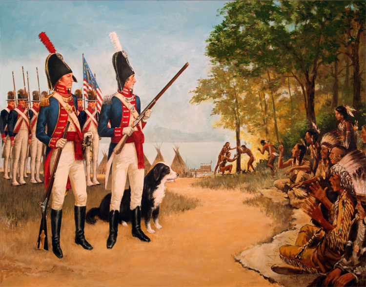
Two hundred years ago, Thomas Jefferson sent Meriwether Lewis and William Clark’s Corps of Discovery to find a water route to the Pacific and explore the uncharted west. Lewis and Clark were everything Jefferson hoped for as explorers—they were literate in their description of flora and fauna, they were trained mapmakers, they had a scientific sense of observation, and they could lead a party of men through the unknown. While they didn’t find the woolly mammoths, erupting volcanoes, or mountains of pure salt that Jefferson imagined, their discoveries were no less mind-boggling: some 300 species unknown to science, nearly 50 Indian tribes, and thousands of miles of uncharted territory. This online “Journey Log” catalogues every tribe, plant, and animal they
 encountered on their expedition, presented with their journals, maps, and drawings, as well as contemporary photographs and illustrations. Visitors follow the Corps of Discovery in this dynamic site through 22 discrete segments based on geographic milestones. A crop of the original William Clark map from 1806 illustrates each segment so that visitors can explore every plant or animal that was discovered, each tribe that was encountered, and examine the related journals and maps. The database-driven backend organizes all the content according to location and time, giving visitors chronological and geographical context for all their findings. In addition, the flexible structure easily accommodated the addition of new content modules over the three-year bicentennial celebration of the expedition.
They went throught the states Virginia, Pennsylvania, West Virginia,Kentucky, Indiana, Illinois, Missouri , Kansas, Iowa, Nebraska, Sought and North Dacota, Montana, Idaho, Washington and Oregon.
